Old maps proving Vietnam’s island sovereignty displayed
Eighteen maps, including four ancient ones, affirming Vietnam’s sovereignty over Hoang Sa (Paracel) and Truong Sa (Spratly) archipelagos, were on display at an exhibition in the southern province of Dong Nai on March 22.
The old maps, including “An Nam dai quoc hoa do” ( Map of the Great Country of An Nam) published in 1838, “Dai Nam thong nhat toan do” ( Complete Map of Unified Dai Nam) published during the Minh Mang reign in 1834, and a 1904 map of Indochinese weather stations.
There was also a Chinese administrative map of provincial boundaries published under the Qing dynasty in 1904. The map shows that the southernmost point of China at that time ended at Hainan Island.
Additionally, the exhibition introduced over 100 photos featuring the two archipelagos as well as activities of Dong Nai people towards the country’s seas and islands.
Tran Dang Ninh, Director of Tran Bien Temple of Literature, where the exhibition took place, said the event will go on until April 30.
Within the framework of the event, there will be a wide range of activities, including a film making contest on Vietnam ’s seas and islands.
Tuoitre News
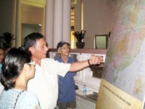 |
Photo: Maps displayed at the exhibition. Photo: VNA |
The old maps, including “An Nam dai quoc hoa do” ( Map of the Great Country of An Nam) published in 1838, “Dai Nam thong nhat toan do” ( Complete Map of Unified Dai Nam) published during the Minh Mang reign in 1834, and a 1904 map of Indochinese weather stations.
There was also a Chinese administrative map of provincial boundaries published under the Qing dynasty in 1904. The map shows that the southernmost point of China at that time ended at Hainan Island.
Additionally, the exhibition introduced over 100 photos featuring the two archipelagos as well as activities of Dong Nai people towards the country’s seas and islands.
Tran Dang Ninh, Director of Tran Bien Temple of Literature, where the exhibition took place, said the event will go on until April 30.
Within the framework of the event, there will be a wide range of activities, including a film making contest on Vietnam ’s seas and islands.
Tuoitre News
My family always say that I am killing my time here at net,
ReplyDeletebut I know I am getting knowledge all the time by reading such fastidious content.
Also visit my web blog: walking calorie calculator